Aerial Surveying

Professional Aerial Surveying & Topographic Drone Surveys

Survey-grade drone surveys for land measurement, topographic mapping, volumetric analysis, and site planning across the South Downs and UK. RTK GPS accuracy to ±20mm. Results delivered within 48 hours.

What we do

Accurate Aerial Surveys That Give You the Full Picture

South Downs Drone Survey Ltd provides professional aerial surveying services for construction companies, civil engineers, planning consultants, local authorities, land managers, and property professionals across the South Downs and the wider United Kingdom.

Using the DJI Matrice 4E RTK with PPK/RTK GPS positioning, our surveys achieve ground sample distances as fine as 1cm/pixel and positional accuracies of ±20mm, meeting the requirements of planning applications, engineering design, and construction management.

Compared to traditional ground survey methods, our drone surveys are faster, safer, more cost-effective, and capture far more data per site visit — allowing you to make better decisions with complete confidence in the numbers.
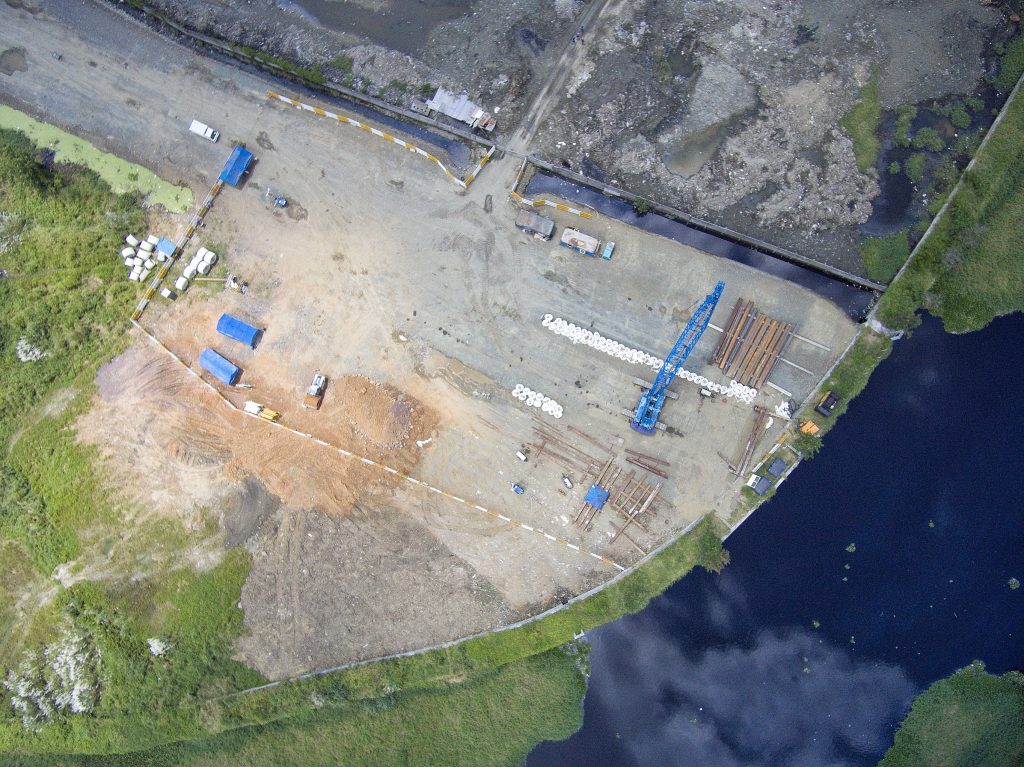
Aerial photography drone above a construction site in the South Downs

What you Receive

Survey Deliverables Tailored to Your Software

All survey deliverables are processed using industry-leading photogrammetry and GIS software including Pix4D, DJI Terra, and ArcGIS — and supplied in the formats your team already uses.

  • Orthomosaic maps (GeoTIFF, ECW)

  • Digital Terrain Models (DTM) and Digital Surface Models (DSM)

  • 3D point clouds (LAS / LAZ format)

  • CAD-compatible DWG / DXF files

  • Volumetric calculations and stockpile reports

  • Contour maps at client-specified intervals

  • Full accuracy report and ground control point data

  • Delivery within 48–72 hours of the survey flight

Who we work with

Drone Surveys Across Every Industry

Construction & Civil Engineering​

Pre-construction topographic surveys, cut-and-fill calculations, progress monitoring, and as-built records.​

Planning & Development​

Accurate site surveys for planning applications, Environmental Impact Assessments, and outline planning submissions.: ​

Land & Estate Management​

Boundary surveys, land area calculations, drainage mapping, and habitat assessment for agricultural and rural estates.: ​

Utilities & Infrastructure​

Corridor surveys for pipelines, power lines, and road schemes across linear sites.​​

Highways & Local Authorities​

Highway condition surveys, public rights of way mapping, and green space assessment.​

Mining & Aggregates​

Stockpile volume calculations, quarry face mapping, and ongoing extraction monitoring.​

Let's Take Your Project to New Heights

Professional drone surveying and aerial imaging. CAA-licensed, fully insured, fast turnaround.

How it Works

From Enquiry to Deliverable in 5 Steps

01

Consultation & Brief

We discuss your project requirements, intended use of data, accuracy needs, and required deliverables

02

Site Assessment & Planning

Remote airspace analysis, GCP planning, regulatory checks, and a detailed risk assessment.:

03

Drone Survey Flight

Our CAA licensed pilots conduct the survey using RTK GPS and systematic flight planning for complete site coverage.:

04

Data Processing

Raw imagery and GPS data is processed using photogrammetry software to produce your survey outputs.

05

Delivery & Support

Completed deliverables sent within 48–72 hours with a full accuracy report. We're on hand to answer any questions.:

Aerial Surveying — Frequently Asked Questions

Using RTK GPS technology and ground control points, our drone surveys achieve positional accuracies of ±20mm horizontally and vertically — meeting the requirements of most planning, engineering, and construction applications.

Topographic drone surveys start from £599 for sites up to 5 hectares. Larger sites and complex projects are priced individually. Contact us for a free, no-obligation quote.

Most sites up to 20 hectares can be surveyed in a single half-day visit. Survey deliverables are typically ready within 48–72 hours of the flight date.

We survey sites from less than 1 hectare up to hundreds of hectares. For very large sites we plan multi-day surveys or use our fixed-wing UAV platform for maximum efficiency.